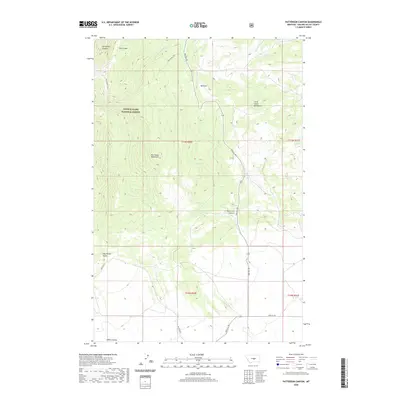
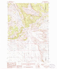
2020 Map of Patterson Canyon
USGS Topo · Published 2020About this map
Lewis & Clark National Forest encompasses much of the high ground in this area, where the Big Snowy Mountains and Little Snowy Mountains meet. The geography is defined by deep drainage patterns and ridges, with Patterson Canyon and Horsethief Canyon cutting through the terrain. Evidence of high-altitude water sources includes McLean Lake and the headwaters of S Fork Flatwillow Cr. Travel through this remote part of Golden Valley County is largely restricted to the Big Snowy Trail and a sparse network of mountain roads such as Red Hill Rd and Metzger Rd. The map illustrates a landscape primarily shaped by natural topography rather than human settlement, with features like Dry Ashley Gulch and Ashley Coulee marking the lower elevations to the south.
Find a feature on this map
19 named features on this map. Tap any name to fly to it.
Don’t see what you’re looking for? This feature index may not catch every label — zoom into the map to look around manually.
Map Details
Editions of this 2020 Patterson Canyon Map
This is the sole edition of this map. No revisions or reprints were ever made.
Other maps of this area

1889 · Big Snowy Mountain
USGS Topo · 1:250,000

1893 · Big Snowy Mountain
USGS Topo · 1:250,000

1954 · Roundup
USGS Topo · 1:250,000

1958 · Roundup
USGS Topo · 1:250,000

1970 · South Bench
USGS Topo · 1:24,000
1970 · Alaska Bench
USGS Topo · 1:24,000
1970 · Half Moon Canyon
USGS Topo · 1:24,000

1986 · Patterson Canyon
USGS Topo · 1:24,000
1986 · Rothiemay
USGS Topo · 1:24,000
1986 · Sahara Hill
USGS Topo · 1:24,000