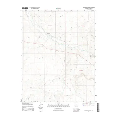
2016 Map of Patterson Crossing
USGS Topo · Published 2016About this map
Patterson Crossing serves as the focal point of this arid landscape, where the management of water dominates the human footprint. The map documents a sophisticated network of irrigation infrastructure designed to divert water from the Purgatoire River, including the Lewelling McCormick Ditch and the Patterson Ditch. These man-made channels reflect the agricultural necessity of the region, cutting across the terrain to sustain local land use near the prominent Purgatoire Canyon.
Find a feature on this map
20 named features on this map. Tap any name to fly to it.
Don’t see what you’re looking for? This feature index may not catch every label — zoom into the map to look around manually.
Map Details
Editions of this 2016 Patterson Crossing Map
This is the sole edition of this map. No revisions or reprints were ever made.
Other maps of this area

1892 · Elmoro
USGS Topo · 1:125,000

1893 · Elmoro
USGS Topo · 1:125,000

1897 · Elmoro
USGS Topo · 1:125,000

1954 · Trinidad
USGS Topo · 1:250,000

1955 · Trinidad
USGS Topo · 1:250,000

1958 · Trinidad
USGS Topo · 1:250,000

1959 · Trinidad
USGS Topo · 1:250,000
1970 · Earl
USGS Topo · 1:24,000
1970 · Mooney Hills
USGS Topo · 1:24,000
1971 · Trinchera Cave
USGS Topo · 1:24,000