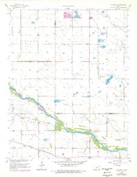
1958 Map of Patterson
USGS Topo · Published 1978About this map
Arkansas River levee systems and sandbars dominate the southern half of this Kansas landscape, where the river winds through Greeley and Haven. The small settlement of Patterson is situated near the center of the sheet, adjacent to Patterson Lake and the San Francisco St Louis railroad line. The map reveals a high concentration of small water bodies and wetlands in the northeast, including Meadow Lake, Saucer Lake, and the Boyle Lakes, which contrast with the more structured agricultural layout found in Valley.
Find a feature on this map
25 named features on this map. Tap any name to fly to it.
Don’t see what you’re looking for? This feature index may not catch every label — zoom into the map to look around manually.
Map Details
Editions of this 1958 Patterson Map
2 editions found
Other maps of this area

1889 · Cheney
USGS Topo · 1:125,000

1891 · Hutchinson
USGS Topo · 1:125,000

1891 · Cheney
USGS Topo · 1:125,000

1893 · Hutchinson
USGS Topo · 1:125,000

1901 · Cheney
USGS Topo · 1:125,000

1955 · Wichita
USGS Topo · 1:250,000

1955 · Hutchinson
USGS Topo · 1:250,000

1958 · Wichita
USGS Topo · 1:250,000

1958 · Patterson
USGS Topo · 1:24,000
1958 · Bentley
USGS Topo · 1:24,000