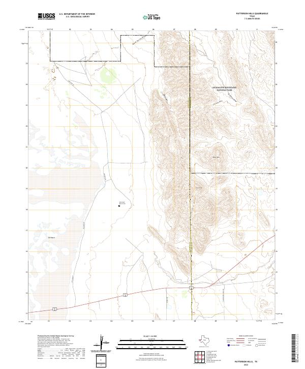
2022 Map of Patterson Hills
USGS Topo · Published 2022About this map
The Hudspeth Co and Culberson Co boundary line bisects this high-desert landscape, dominated by the prominent elevations of the Patterson Hills. To the east, the terrain rises into the southern reaches of Guadalupe Mountains National Park, where drainages like Big Canyon and Little Sandy Draw carve through the foothills. The western portion of the map is defined by the broad, low expanse of the Salt Basin, a stark contrast to the nearby summits of Cone Peak and Quail Mtn.
Find a feature on this map
14 named features on this map. Tap any name to fly to it.
Don’t see what you’re looking for? This feature index may not catch every label — zoom into the map to look around manually.
Map Details
Editions of this 2022 Patterson Hills Map
This is the sole edition of this map. No revisions or reprints were ever made.
Other maps of this area

1933 · Guadalupe Peak
USGS Topo · 1:48,000

1940 · Guadalupe Peak
USGS Topo · 1:62,500

1951 · Dell City
USGS Topo · 1:62,500

1954 · Van Horn
USGS Topo · 1:250,000

1955 · Black Mountains
USGS Topo · 1:62,500

1958 · Van Horn
USGS Topo · 1:250,000

1973 · Bitter Well Mountain NW
USGS Topo · 1:24,000
1973 · Patterson Hills
USGS Topo · 1:24,000
1973 · Six Bar Ranch
USGS Topo · 1:24,000
1973 · Guadalupe Peak
USGS Topo · 1:24,000