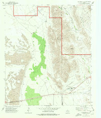
1973 Map of Patterson Hills
USGS Topo · Published 1976About this map
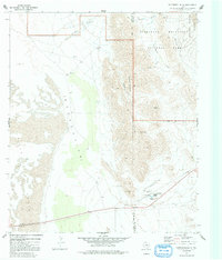
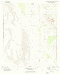
Guadalupe Mountains National Park dominates the eastern landscape of this West Texas survey, where the rugged uplift meets the flat expanse of the Salt Basin (Depression). The map preserves the alignment of the Butterfield Trail as it crosses the high desert terrain, serving as a reminder of the mid-19th-century overland mail route that once traversed this arid corridor. Small outposts of activity are concentrated in the south, including the Guadalupe Sch, a Radio Tower, and the Guadalupe Pumping Sta, which supported the local infrastructure of Hudspeth and Culberson counties.
Find a feature on this map
25 named features on this map. Tap any name to fly to it.
Don’t see what you’re looking for? This feature index may not catch every label — zoom into the map to look around manually.
Map Details
Editions of this 1973 Patterson Hills Map
2 editions found
Other maps of this area

1933 · Guadalupe Peak
USGS Topo · 1:48,000

1940 · Guadalupe Peak
USGS Topo · 1:62,500
1951 · Dell City
USGS Topo · 1:62,500

1954 · Van Horn
USGS Topo · 1:250,000
1955 · Black Mountains
USGS Topo · 1:62,500

1958 · Van Horn
USGS Topo · 1:250,000
1973 · Bitter Well Mountain NW
USGS Topo · 1:24,000
1973 · Six Bar Ranch
USGS Topo · 1:24,000

1973 · Guadalupe Peak
USGS Topo · 1:24,000
1973 · Guadalupe Pass
USGS Topo · 1:24,000