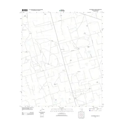
2012 Map of Patterson Lake
USGS Topo · Published 2012About this map
Patterson Lake provides a central reference point in this corner of the Permian Basin, a landscape defined by ranching operations and water management in Glasscock County. The terrain is marked by a network of private roads and county routes, including Co RD 110 and Co RD 130, which connect a series of family-named agricultural holdings. Ranching legacies are visible through the presence of the Brunson Ranch, Wrage Ranch, and McDaniel Ranch, each supported by the essential infrastructure of the West Texas plains. Numerous named windmills, such as Grandpa's Windmill, Jackson Hole Windmill, and the uniquely titled Section and a Half Windmill, reveal the critical importance of groundwater for sustaining the cattle industry in this arid environment. The map details a specialized rural economy where land is organized into large sections, as seen with the Two Section Windmill.
Find a feature on this map
32 named features on this map. Tap any name to fly to it.
Don’t see what you’re looking for? This feature index may not catch every label — zoom into the map to look around manually.
Map Details
Editions of this 2012 Patterson Lake Map
This is the sole edition of this map. No revisions or reprints were ever made.
Other maps of this area

1954 · San Angelo
USGS Topo · 1:250,000

1958 · San Angelo
USGS Topo · 1:250,000

1964 · Dewey Lake NE
USGS Topo · 1:24,000

1965 · San Angelo
USGS Topo · 1:250,000

1965 · Dewey Lake
USGS Topo · 1:24,000

1965 · Spraberry
USGS Topo · 1:24,000

1965 · Dewey Lake SE
USGS Topo · 1:24,000

1965 · Pecks Lake
USGS Topo · 1:24,000

1965 · Patterson Lake
USGS Topo · 1:24,000

1967 · Midkiff
USGS Topo · 1:24,000