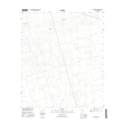
2016 Map of Patterson Lake
USGS Topo · Published 2016About this map
Patterson Lake anchors this portion of the West Texas landscape, surrounded by the characteristic drainage patterns of the Llano Estacado. The terrain is defined by seasonal watercourses and natural depressions, most notably Pemberton Draw and Meyers Draw, which carve gentle relief into the plains. The map reflects a contemporary rural infrastructure where the land is organized into a precise grid of county roads, including Co Rd 110 and Co Rd 135. Evidence of ranching and land management is visible in the network of tanks and the distinctive path of Thirtysix Draw. This survey serves as a record of the high plains environment, showing how modern transportation routes and water resources continue to dictate the human footprint in this part of Glasscock County.
Find a feature on this map
8 named features on this map. Tap any name to fly to it.
Don’t see what you’re looking for? This feature index may not catch every label — zoom into the map to look around manually.
Map Details
Editions of this 2016 Patterson Lake Map
This is the sole edition of this map. No revisions or reprints were ever made.
Other maps of this area

1954 · San Angelo
USGS Topo · 1:250,000

1958 · San Angelo
USGS Topo · 1:250,000

1964 · Dewey Lake NE
USGS Topo · 1:24,000

1965 · San Angelo
USGS Topo · 1:250,000

1965 · Dewey Lake
USGS Topo · 1:24,000

1965 · Spraberry
USGS Topo · 1:24,000

1965 · Dewey Lake SE
USGS Topo · 1:24,000

1965 · Pecks Lake
USGS Topo · 1:24,000

1965 · Patterson Lake
USGS Topo · 1:24,000

1967 · Midkiff
USGS Topo · 1:24,000