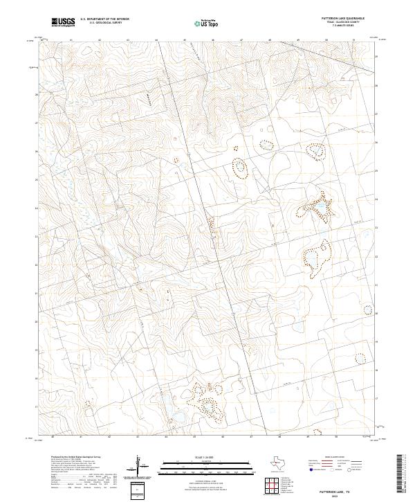
2022 Map of Patterson Lake
USGS Topo · Published 2022About this map
Patterson Lake provides a central water source in this high-plains landscape of Glasscock County, where the terrain is defined by dry drainage systems rather than permanent rivers. The local topography is carved by ephemeral waterways including Meyers Draw and Thirtysix Draw, reflecting the arid nature of this region. Human activity is largely structured around a sparse but deliberate network of secondary routes and country roads, notably Co Rd 110 and Co Rd 130, which cross the rolling contours to connect isolated ranching or industrial sites. This modern survey illustrates the expansive, open-country layout typical of West Texas, where large-scale land management and natural drainage patterns dictate the placement of local infrastructure and the utilization of the basin surrounding the lake.
Find a feature on this map
9 named features on this map. Tap any name to fly to it.
Don’t see what you’re looking for? This feature index may not catch every label — zoom into the map to look around manually.
Map Details
Editions of this 2022 Patterson Lake Map
This is the sole edition of this map. No revisions or reprints were ever made.
Other maps of this area

1954 · San Angelo
USGS Topo · 1:250,000

1958 · San Angelo
USGS Topo · 1:250,000

1964 · Dewey Lake NE
USGS Topo · 1:24,000

1965 · San Angelo
USGS Topo · 1:250,000

1965 · Dewey Lake
USGS Topo · 1:24,000

1965 · Spraberry
USGS Topo · 1:24,000

1965 · Dewey Lake SE
USGS Topo · 1:24,000

1965 · Pecks Lake
USGS Topo · 1:24,000

1965 · Patterson Lake
USGS Topo · 1:24,000

1967 · Midkiff
USGS Topo · 1:24,000