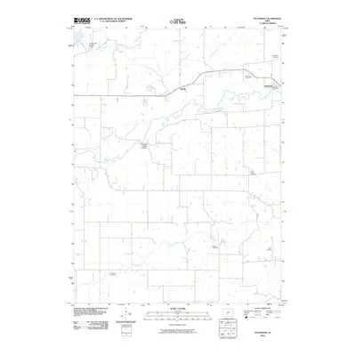
2010 Map of Patterson
USGS Topo · Published 2010About this map
Patterson anchors the eastern edge of this landscape, where the Middle River winds through the central valley. The map documents a rural Iowa community defined by its watercourses and a remarkable concentration of historic preservation, most notably the Cedar Creek Covered Bridge in the north and the Holliwell Covered Bridge further south. These landmarks, along with smaller settlements like Tileville and Tola, highlight a region where the traditional agricultural layout remains largely intact.
Find a feature on this map
15 named features on this map. Tap any name to fly to it.
Don’t see what you’re looking for? This feature index may not catch every label — zoom into the map to look around manually.
Map Details
Editions of this 2010 Patterson Map
This is the sole edition of this map. No revisions or reprints were ever made.
Other maps of this area

1951 · Osceola
USGS Topo · 1:62,500

1951 · St. Charles
USGS Topo · 1:62,500

1951 · Afton
USGS Topo · 1:62,500

1952 · Winterset
USGS Topo · 1:62,500

1954 · Omaha
USGS Topo · 1:250,000

1954 · Des Moines
USGS Topo · 1:250,000

1956 · Des Moines
USGS Topo · 1:250,000

1957 · Des Moines
USGS Topo · 1:250,000

1957 · Omaha
USGS Topo · 1:250,000

1958 · Omaha
USGS Topo · 1:250,000