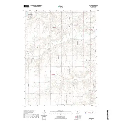
2018 Map of Patterson
USGS Topo · Published 2018About this map
The Cedar Creek Covered Bridge and the Holliwell Covered Bridge define the historic character of this Madison County landscape, where the Middle River and Cedar Cr wind through the township divisions of T76N and T75N. This survey documents the area between Winterset and Patterson, showing a rural network of named trails and roads such as Hiatt Apple Trl and Settlers Trl. For genealogists, the map is a vital resource for locating numerous small burial grounds including Montpelier Cem, McGinnis Cem, Union Chapel Cem, and Beardsley Cem. The terrain is characterized by the convergence of several waterways, including Jones Cr, and the prominence of Cedar Lake to the northwest. This detailed modern record reflects the enduring agricultural layout of the region while preserving the precise locations of its iconic covered bridges and ancestral cemeteries.
Find a feature on this map
62 named features on this map. Tap any name to fly to it.
Don’t see what you’re looking for? This feature index may not catch every label — zoom into the map to look around manually.
Map Details
Editions of this 2018 Patterson Map
This is the sole edition of this map. No revisions or reprints were ever made.
Other maps of this area

1951 · Osceola
USGS Topo · 1:62,500

1951 · St. Charles
USGS Topo · 1:62,500

1951 · Afton
USGS Topo · 1:62,500

1952 · Winterset
USGS Topo · 1:62,500

1954 · Omaha
USGS Topo · 1:250,000

1954 · Des Moines
USGS Topo · 1:250,000

1956 · Des Moines
USGS Topo · 1:250,000

1957 · Des Moines
USGS Topo · 1:250,000

1957 · Omaha
USGS Topo · 1:250,000

1958 · Omaha
USGS Topo · 1:250,000