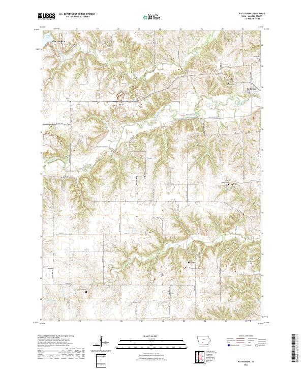
2022 Map of Patterson
USGS Topo · Published 2022About this map
The Middle River winds through the heart of Madison County, Iowa, creating a deeply dissected landscape where timbered ridges meet fertile valley bottoms. Near the western edge of this survey lies the outskirts of Winterset, while the town of Patterson is positioned along the river to the east. The terrain is marked by a network of rural trails and roads, including Holliwell Bridge Rd and Hiatt Apple Trl, reflecting the region’s agricultural roots and its famous association with local landmarks. Numerous family and community burial grounds are scattered throughout the hills, such as Montpelier Cem, McGinnis Cem, and King Cem, providing essential points of reference for genealogical research. North of the main river valley, Cedar Lake and Cedar Cr define the local drainage patterns as they flow through the northern townships.
Find a feature on this map
59 named features on this map. Tap any name to fly to it.
Don’t see what you’re looking for? This feature index may not catch every label — zoom into the map to look around manually.
Map Details
Editions of this 2022 Patterson Map
This is the sole edition of this map. No revisions or reprints were ever made.
Other maps of this area

1951 · Osceola
USGS Topo · 1:62,500

1951 · St. Charles
USGS Topo · 1:62,500

1951 · Afton
USGS Topo · 1:62,500

1952 · Winterset
USGS Topo · 1:62,500

1954 · Omaha
USGS Topo · 1:250,000

1954 · Des Moines
USGS Topo · 1:250,000

1956 · Des Moines
USGS Topo · 1:250,000

1957 · Des Moines
USGS Topo · 1:250,000

1957 · Omaha
USGS Topo · 1:250,000

1958 · Omaha
USGS Topo · 1:250,000