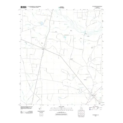
2011 Map of Patterson
USGS Topo · Published 2011About this map
Patterson anchors the southeastern corner of this Pierce County survey, situated at a junction of rail and road where the local economy transitions into timber and aviation at the Forestry-Strip Airport. The landscape is defined by the slow-moving waters of Big Satilla Creek and its many tributaries, including Sixty Foot Branch and Fishing Creek. These watercourses dictated the early settlement patterns of the region, visible in the distribution of family and community burial grounds such as Bird Cemetery, Ashley Cemetery, and Tyre Cemetery. Small rural centers like Bristol and Aspinwall serve as local hubs within a grid of legacy roads, many bearing names like WPA Rd that hint at mid-century infrastructure developments. The presence of Youmans Lake Dam and the Tyre Bridge over the Satilla further highlight the historical importance of water management and crossing points in this part of Georgia.
Find a feature on this map
89 named features on this map. Tap any name to fly to it.
Don’t see what you’re looking for? This feature index may not catch every label — zoom into the map to look around manually.
Map Details
Editions of this 2011 Patterson Map
This is the sole edition of this map. No revisions or reprints were ever made.
Other maps of this area

1953 · Waycross
USGS Topo · 1:250,000

1958 · Waycross
USGS Topo · 1:250,000
1971 · Ritch
USGS Topo · 1:24,000

1971 · Coffee
USGS Topo · 1:24,000

1971 · Blackshear East
USGS Topo · 1:24,000

1971 · K'ville
USGS Topo · 1:24,000

1971 · Patterson
USGS Topo · 1:24,000
1971 · Screven
USGS Topo · 1:24,000

1971 · Blackshear West
USGS Topo · 1:24,000

1971 · Mershon
USGS Topo · 1:24,000