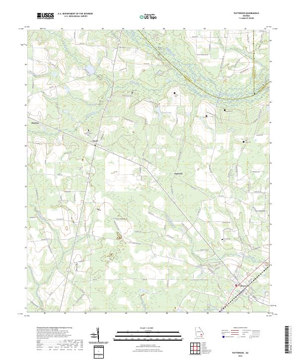
2024 Map of Patterson
USGS Topo · Published 2024About this map
Patterson and the surrounding Pierce County landscape are defined by a network of agricultural roads and winding watercourses like Big Satilla Creek and Fishing Creek. This rural pocket of Georgia is dotted with several family and community landmarks that provide significant value for genealogical research, including the Bristol Baptist Church and a series of burial grounds such as Aspinwall Cem and Mill Creek Cem. The settlement patterns here follow established crossroads and rail corridors, connecting smaller localities like Mershon, Bristol, and Aspinwall.
Find a feature on this map
119 named features on this map. Tap any name to fly to it.
Don’t see what you’re looking for? This feature index may not catch every label — zoom into the map to look around manually.
Map Details
Editions of this 2024 Patterson Map
This is the sole edition of this map. No revisions or reprints were ever made.
Other maps of this area

1953 · Waycross
USGS Topo · 1:250,000

1958 · Waycross
USGS Topo · 1:250,000
1971 · Ritch
USGS Topo · 1:24,000

1971 · Coffee
USGS Topo · 1:24,000

1971 · Blackshear East
USGS Topo · 1:24,000

1971 · K'ville
USGS Topo · 1:24,000

1971 · Patterson
USGS Topo · 1:24,000
1971 · Screven
USGS Topo · 1:24,000

1971 · Blackshear West
USGS Topo · 1:24,000

1971 · Mershon
USGS Topo · 1:24,000