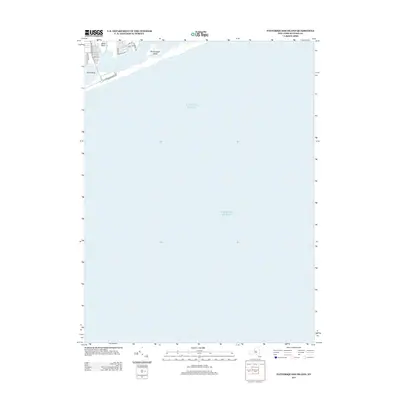
2013 Map of Pattersquash Island
USGS Topo · Published 2013About this map
Pattersquash Island sits isolated within the coastal waters of the South Shore, where the barrier beach meets the vast expanse of the Atlantic Ocean. This 2013 survey of the Brookhaven area shows a landscape defined by the tidal inlets and finger-like peninsulas of Johns Neck, separated by Unkechogue Cr, Johns Neck Cr, and Sheppen Cr.
Find a feature on this map
15 named features on this map. Tap any name to fly to it.
Don’t see what you’re looking for? This feature index may not catch every label — zoom into the map to look around manually.
Map Details
Editions of this 2013 Pattersquash Island Map
This is the sole edition of this map. No revisions or reprints were ever made.
Other maps of this area

1903 · Riverhead
USGS Topo · 1:62,500

1904 · Riverhead
USGS Topo · 1:62,500

1904 · Moriches
USGS Topo · 1:62,500

1943 · Riverhead
USGS Topo · 1:62,500

1947 · Bellport
USGS Topo · 1:24,000

1947 · Howells Point
USGS Topo · 1:24,000

1947 · Eastport
USGS Topo · 1:24,000

1949 · New York
USGS Topo · 1:250,000

1954 · New York
USGS Topo · 1:250,000
1956 · Howells Point
USGS Topo · 1:24,000