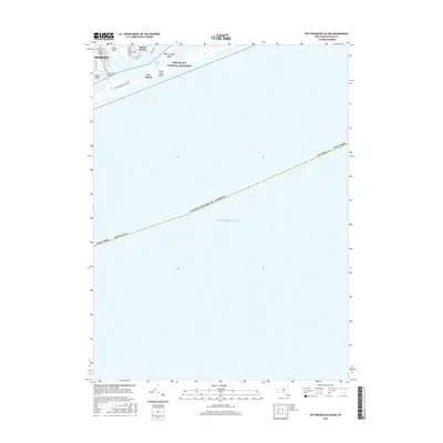
2016 Map of Pattersquash Island
USGS Topo · Published 2016About this map
Fire Island National Seashore dominates the coastal geography of this Long Island survey, illustrating the narrow barrier island system that protects the mainland from the Atlantic Ocean. The settlement of Mastic Beach and the community of Shirley are positioned along the northern shore of Narrow Bay, connected to the outer beach via the Narrow Bay Bridge. This map highlights the transition between suburban residential development on Johns Neck and the protected, natural landscape of Fire Island and Pattersquash Island. The road network, including Trafalgar Dr and Riviera Rd, shows the dense residential patterning characteristic of the southern Suffolk County shoreline during the early 21st century. The map also delineates the jurisdictional boundary of the United States of America as it extends into the Atlantic.
Find a feature on this map
21 named features on this map. Tap any name to fly to it.
Don’t see what you’re looking for? This feature index may not catch every label — zoom into the map to look around manually.
Map Details
Editions of this 2016 Pattersquash Island Map
This is the sole edition of this map. No revisions or reprints were ever made.
Other maps of this area

1903 · Riverhead
USGS Topo · 1:62,500

1904 · Riverhead
USGS Topo · 1:62,500

1904 · Moriches
USGS Topo · 1:62,500

1943 · Riverhead
USGS Topo · 1:62,500

1947 · Bellport
USGS Topo · 1:24,000

1947 · Howells Point
USGS Topo · 1:24,000

1947 · Eastport
USGS Topo · 1:24,000

1949 · New York
USGS Topo · 1:250,000

1954 · New York
USGS Topo · 1:250,000
1956 · Howells Point
USGS Topo · 1:24,000