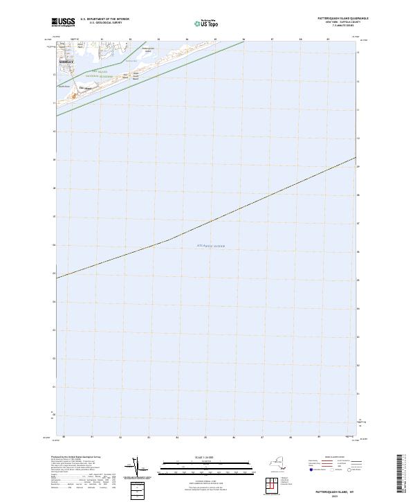
2023 Map of Pattersquash Island
USGS Topo · Published 2023About this map
Pattersquash Island sits at the heart of this coastal study, positioned within the protected waters of Narrow Bay along the southern edge of Long Island. The map documents the delicate barrier island geography where Great South Beach meets the Atlantic Ocean, a landscape largely defined by the Fire Island National Seashore. To the west, the residential patterns of Shirley and the street grid including Huntington Dr and Riviera Dr terminate at the shoreline, highlighting the interface between suburban development and the preserved wetlands of Johns Neck. The southern portion of the sheet is dominated by the Otis Pike Fire Island High Dune Wilderness, showing the undeveloped state of the dunes near Smith Point and Sheepen Creek.
Find a feature on this map
14 named features on this map. Tap any name to fly to it.
Don’t see what you’re looking for? This feature index may not catch every label — zoom into the map to look around manually.
Map Details
Editions of this 2023 Pattersquash Island Map
This is the sole edition of this map. No revisions or reprints were ever made.
Other maps of this area

1903 · Riverhead
USGS Topo · 1:62,500

1904 · Riverhead
USGS Topo · 1:62,500

1904 · Moriches
USGS Topo · 1:62,500

1943 · Riverhead
USGS Topo · 1:62,500

1947 · Bellport
USGS Topo · 1:24,000

1947 · Howells Point
USGS Topo · 1:24,000

1947 · Eastport
USGS Topo · 1:24,000

1949 · New York
USGS Topo · 1:250,000

1954 · New York
USGS Topo · 1:250,000
1956 · Howells Point
USGS Topo · 1:24,000