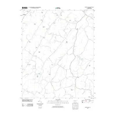
2010 Map of Pattie Gap
USGS Topo · Published 2010About this map
Mount Cumberland Cemetery and Richardson Cemetery sit among the ridges of eastern Roane County, illustrating the deep ancestral roots tied to this landscape. The terrain is defined by a series of parallel elevations including Hurricane Ridge, Riley Ridge, and Walker Ridge, which channel the local road network through low-lying areas like Paint Rock Valley and Dry Fork Valley. Small settlements such as Oak Hill and Luttrell serve as local hubs, connected by a web of rural routes like Salem Valley Rd and Blue Springs Rd. For genealogists, the map is remarkably dense with family-named burial grounds, from Deatherage Cemetery in the north to Fisher Cemetery in the south, reflecting a settlement pattern where communities remained centered around family homesteads and local springs like Blue Spring and Galyon Spring.
Find a feature on this map
74 named features on this map. Tap any name to fly to it.
Don’t see what you’re looking for? This feature index may not catch every label — zoom into the map to look around manually.
Map Details
Editions of this 2010 Pattie Gap Map
This is the sole edition of this map. No revisions or reprints were ever made.
Other maps of this area

1887 · Kingston
USGS Topo · 1:125,000

1891 · Kingston
USGS Topo · 1:125,000

1893 · Kingston
USGS Topo · 1:125,000

1895 · Loudon
USGS Topo · 1:125,000

1935 · Niota
USGS Topo · 1:24,000

1935 · Rockwood
USGS Topo · 1:24,000

1935 · Philadelphia
USGS Topo · 1:24,000

1936 · Cave Creek
USGS Topo · 1:24,000
1936 · Sweetwater
USGS Topo · 1:24,000
1936 · Pattie Gap
USGS Topo · 1:24,000