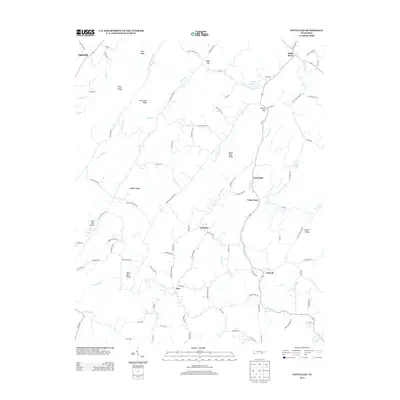
2013 Map of Pattie Gap
USGS Topo · Published 2013About this map
Paint Rock Creek winds through this section of Roane County, anchoring a landscape defined by prominent ridgelines and several small rural communities. The settlements of Oak Hill, Paint Rock, and Luttrell are distributed across a series of parallel valleys, including Paint Rock Valley and Dry Fork Valley. This topography creates a distinct pattern of isolated hollows and long narrow ridges, such as Hurricane Ridge and Galyon Ridge, where local life followed the available waterways and natural gaps.
Find a feature on this map
108 named features on this map. Tap any name to fly to it.
Don’t see what you’re looking for? This feature index may not catch every label — zoom into the map to look around manually.
Map Details
Editions of this 2013 Pattie Gap Map
This is the sole edition of this map. No revisions or reprints were ever made.
Other maps of this area

1887 · Kingston
USGS Topo · 1:125,000

1891 · Kingston
USGS Topo · 1:125,000

1893 · Kingston
USGS Topo · 1:125,000

1895 · Loudon
USGS Topo · 1:125,000

1935 · Niota
USGS Topo · 1:24,000

1935 · Rockwood
USGS Topo · 1:24,000

1935 · Philadelphia
USGS Topo · 1:24,000

1936 · Cave Creek
USGS Topo · 1:24,000
1936 · Sweetwater
USGS Topo · 1:24,000
1936 · Pattie Gap
USGS Topo · 1:24,000