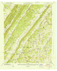
1940 Map of Pattie Gap
USGS Topo · Published 1940About this map
Paint Rock Ridge and Hurricane Ridge dictate the settlement patterns of this 1940 survey, where small communities and family farmsteads are tucked into the narrow valleys of East Tennessee. The landscape is defined by its social infrastructure, featuring a high density of rural institutions like the Compromise Sch and Salem Ch. The Tennessee Valley Authority's influence is evident in the precise mapping of boundaries across Roane and Loudon Counties, while local commerce is represented by sites like Morrison Store and the Cook Mill on Little Paint Rock Creek. Genealogical interest is found in numerous family-named landmarks, including the Fuller Cem and Mathis Cem, which dot the hillsides near Barnard Br and Stamp Creek. This era captures the area just as modern infrastructure began to weave through the gaps, such as the eponymous Pattie Gap.
Find a feature on this map
50 named features on this map. Tap any name to fly to it.
Don’t see what you’re looking for? This feature index may not catch every label — zoom into the map to look around manually.
Map Details
Editions of this 1940 Pattie Gap Map
This is the sole edition of this map. No revisions or reprints were ever made.
Other maps of this area

1887 · Kingston
USGS Topo · 1:125,000

1891 · Kingston
USGS Topo · 1:125,000

1893 · Kingston
USGS Topo · 1:125,000

1895 · Loudon
USGS Topo · 1:125,000

1935 · Niota
USGS Topo · 1:24,000

1935 · Rockwood
USGS Topo · 1:24,000

1935 · Philadelphia
USGS Topo · 1:24,000

1936 · Cave Creek
USGS Topo · 1:24,000
1936 · Sweetwater
USGS Topo · 1:24,000
1936 · Pattie Gap
USGS Topo · 1:24,000