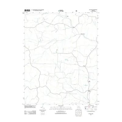
2011 Map of Patton
USGS Topo · Published 2011About this map
Patton Junction and the surrounding rural landscape in Perry County are defined by the winding network of the Upper Whitewater Creek and its many tributaries. This 2011 survey illustrates a transition from the agricultural plateaus to the north near Yount toward the more established settlement clusters at the southern edge. The map reveals the local importance of water management and milling history, centered on landmarks like Heitmans Mill and Fulton Dam. Small communities and named crossroads such as Precinct and North Patton appear connected by an intricate system of county roads, while the presence of Pleasant Hill Cemetery and private water bodies like Destitute Acres Lake and Grindstaff Lake provides critical detail for genealogists and local historians tracking family lands in this part of Missouri.
Find a feature on this map
52 named features on this map. Tap any name to fly to it.
Don’t see what you’re looking for? This feature index may not catch every label — zoom into the map to look around manually.
Map Details
Editions of this 2011 Patton Map
This is the sole edition of this map. No revisions or reprints were ever made.
Other maps of this area

1910 · Higdon
USGS Topo · 1:62,500

1923 · Perryville
USGS Topo · 1:62,500

1924 · Perryville
USGS Topo · 1:62,500

1933 · Marble Hill
USGS Topo · 1:62,500

1933 · Marquand
USGS Topo · 1:62,500

1937 · Marble Hill
USGS Topo · 1:62,500

1938 · Marquand
USGS Topo · 1:62,500

1949 · Paducah
USGS Topo · 1:250,000

1949 · Rolla
USGS Topo · 1:250,000

1950 · Paducah
USGS Topo · 1:250,000