
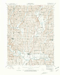
1944 Map of Pattonsburg
USGS Topo · Published 1977About this map
Pattonsburg serves as a principal hub in this 1944 portrait of Northwest Missouri, situated where the Wabash railroad corridor meets the winding Grand River. This survey captures a rural landscape defined by tight-knit school districts and family-named cemeteries, reflecting a period when the agrarian economy was anchored by local post offices like the Coffey P O and Sta. The terrain is marked by numerous small-scale crossings such as the Mooney Bridge and various numbered bridges like BR 829, which navigated the many tributaries of Big Creek and Sampson Creek.
Find a feature on this map
89 named features on this map. Tap any name to fly to it.
Don’t see what you’re looking for? This feature index may not catch every label — zoom into the map to look around manually.
Map Details
Editions of this 1944 Pattonsburg Map
2 editions found
Other maps of this area

1922 · Gallatin
USGS Topo · 1:62,500

1923 · Maysville
USGS Topo · 1:62,500

1924 · Winston
USGS Topo · 1:62,500

1925 · Pattonsburg
USGS Topo · 1:62,500

1925 · Gilman
USGS Topo · 1:62,500

1925 · Maysville
USGS Topo · 1:62,500

1925 · Darlington
USGS Topo · 1:62,500

1942 · Grant City
USGS Topo · 1:62,500

1943 · Grant City
USGS Topo · 1:62,500

1946 · Gilman
USGS Topo · 1:48,000