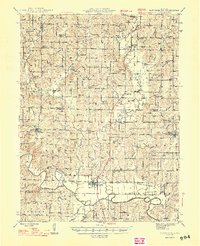
1948 Map of Pattonsburg
USGS Topo · Published 1948About this map
Pattonsburg serves as a focal point for this Northwest Missouri landscape, where the Grand River meanders in deep loops across the southern township of Grand River. The mid-century agrarian character of the region is evident in the dense network of rural schoolhouses and churches that anchored these communities, such as Maize Sch, Virginia Ridge Sch, and Union Chapel. In the northeast, Salem Coffey PO and Sta highlights the critical role of the Wabash railroad in connecting small towns like McFall and Mitchellville to broader markets.
Find a feature on this map
98 named features on this map. Tap any name to fly to it.
Don’t see what you’re looking for? This feature index may not catch every label — zoom into the map to look around manually.
Map Details
Editions of this 1948 Pattonsburg Map
2 editions found

Other maps of this area

1922 · Gallatin
USGS Topo · 1:62,500

1923 · Maysville
USGS Topo · 1:62,500

1924 · Winston
USGS Topo · 1:62,500

1925 · Pattonsburg
USGS Topo · 1:62,500

1925 · Gilman
USGS Topo · 1:62,500

1925 · Maysville
USGS Topo · 1:62,500

1925 · Darlington
USGS Topo · 1:62,500

1942 · Grant City
USGS Topo · 1:62,500

1943 · Grant City
USGS Topo · 1:62,500

1944 · Pattonsburg
USGS Topo · 1:62,500