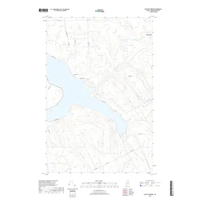
2018 Map of Paulette Brook
USGS Topo · Published 2018About this map
Long Lake dominates this northern Maine landscape, carving through the high terrain of Aroostook County. Along the northeastern shore, Daigle Mill serves as a reminder of the local industry that historically sustained these lakeside communities. The surrounding ridges are defined by landmarks such as Little Mountain and Cold Mtn, while a complex network of waterways, including Paulette Brook and Violette Stream, drains into the larger lake system. Roads like Lavertu Rd and Sullivan Rd trace the contours of the land, connecting scattered homesteads and recreational sites. This survey illustrates the modern configuration of the shoreline and the upland forests, providing a clear view of the area's rural character and its orientation around Violette Pond and the extensive marshlands that feed into Mud Brook.
Find a feature on this map
24 named features on this map. Tap any name to fly to it.
Don’t see what you’re looking for? This feature index may not catch every label — zoom into the map to look around manually.
Map Details
Editions of this 2018 Paulette Brook Map
This is the sole edition of this map. No revisions or reprints were ever made.
Other maps of this area

1927 · Stockholm
USGS Topo · 1:48,000

1927 · Square Lake
USGS Topo · 1:48,000

1931 · Square Lake
USGS Topo · 1:62,500

1931 · Stockholm
USGS Topo · 1:62,500

1932 · Frenchville
USGS Topo · 1:48,000

1935 · Frenchville
USGS Topo · 1:62,500

1938 · Grand Isle
USGS Topo · 1:62,500

1940 · Grand Isle
USGS Topo · 1:62,500

1953 · Stockholm
USGS Topo · 1:62,500

1953 · Square Lake
USGS Topo · 1:62,500