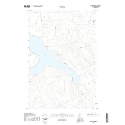
2021 Map of Paulette Brook
USGS Topo · Published 2021About this map
Long Lake dominates the central landscape of this Aroostook County quadrangle, where the steep terrain of the Maine woods is etched by a complex network of timber and access roads. The settlement at Daigle Mill sits in the northeast corner, a point of historic local industry near the banks of Daigle Brook. To the east, the elevation rises sharply toward the summit of Cold Mtn, which overlooks the drainage of Paulette Brook and Violette Stream. The map reveals a contemporary rural infrastructure defined by long, winding routes such as Lake Shore Rd, Baie Creuse Rd, and Sullivan Rd, tracing the contours of the upland ridges and the irregular shoreline. This 2021 survey provides a clear view of how modern land use, from recreation around Violette Pond to the preservation of drainages like Armstrong Brook, continues to shape this northern borderland.
Find a feature on this map
25 named features on this map. Tap any name to fly to it.
Don’t see what you’re looking for? This feature index may not catch every label — zoom into the map to look around manually.
Map Details
Editions of this 2021 Paulette Brook Map
This is the sole edition of this map. No revisions or reprints were ever made.
Other maps of this area

1927 · Stockholm
USGS Topo · 1:48,000

1927 · Square Lake
USGS Topo · 1:48,000

1931 · Square Lake
USGS Topo · 1:62,500

1931 · Stockholm
USGS Topo · 1:62,500

1932 · Frenchville
USGS Topo · 1:48,000

1935 · Frenchville
USGS Topo · 1:62,500

1938 · Grand Isle
USGS Topo · 1:62,500

1940 · Grand Isle
USGS Topo · 1:62,500

1953 · Stockholm
USGS Topo · 1:62,500

1953 · Square Lake
USGS Topo · 1:62,500