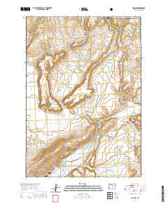
2020 Map of Paulina
USGS Topo · Published 2020About this map
Paulina serves as the focal point for this high-desert landscape in eastern Crook County, situated where Beaver Creek and the Paulina Suplee Rd meet. The township is characterized by a network of seasonal watercourses and reservoirs, including Geodetic Reservoir and Ritch-Fayne Reservoir, which support the ranching operations throughout the Paulina Valley. The northern reaches of the map transition into the Ochoco National Forest, defined by significant elevations such as Big Rattlesnake Butte and Ruby Butte. The terrain is marked by distinct geological features with descriptive names like Hewed Log Hollow, Moccasin Ridge, and Birdsong Butte, suggesting a history of local land use and naming traditions. South of the main settlement, the land rises toward Remington Ridge and Henry Rim, while the eastern portion contains the expansive Mills Reservoir and the drainage of N Wolf Cr.
Find a feature on this map
52 named features on this map. Tap any name to fly to it.
Don’t see what you’re looking for? This feature index may not catch every label — zoom into the map to look around manually.
Map Details
Editions of this 2020 Paulina Map
This is the sole edition of this map. No revisions or reprints were ever made.
Other maps of this area

1932 · Dayville
USGS Topo · 1:125,000

1936 · Dayville
USGS Topo · 1:125,000

1955 · Bend
USGS Topo · 1:250,000

1955 · Canyon City
USGS Topo · 1:250,000

1957 · Bend
USGS Topo · 1:250,000

1958 · Bend
USGS Topo · 1:250,000

1959 · Canyon City
USGS Topo · 1:250,000

1966 · Keys Creek
USGS Topo · 1:24,000

1966 · Little Summit Prairie
USGS Topo · 1:24,000

1966 · Six Corners
USGS Topo · 1:24,000