
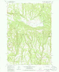
1966 Map of Little Summit Prairie
USGS Topo · Published 1968About this map
Little Summit Prairie sits at the heart of this mid-century survey, a distinctive high-elevation opening within the Ochoco National Forest. The landscape is a network of ridges and drainages defined by Little Summit Creek and its many tributaries, including Thornton Creek and Wolf Creek. Water management for cattle or timber operations is evident through numerous named resources such as Morgan Reservoir, Ruby Reservoir, and Hook Reservoir.
Find a feature on this map
43 named features on this map. Tap any name to fly to it.
Don’t see what you’re looking for? This feature index may not catch every label — zoom into the map to look around manually.
Map Details
Editions of this 1966 Little Summit Prairie Map
2 editions found
Other maps of this area

1932 · Dayville
USGS Topo · 1:125,000

1936 · Dayville
USGS Topo · 1:125,000

1955 · Bend
USGS Topo · 1:250,000

1955 · Canyon City
USGS Topo · 1:250,000

1957 · Bend
USGS Topo · 1:250,000

1958 · Bend
USGS Topo · 1:250,000

1959 · Canyon City
USGS Topo · 1:250,000

1966 · Keys Creek
USGS Topo · 1:24,000

1966 · Peterson Point
USGS Topo · 1:24,000

1966 · Antone
USGS Topo · 1:24,000