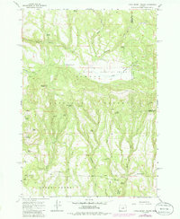
1966 Map of Little Summit Prairie
USGS Topo · Published 1985About this map
Little Summit Prairie sits at the heart of this high-elevation landscape within the Ochoco National Forest. The 1966 data, revised in the mid-1980s, reveals a terrain defined by its water sources and ridges, including the prominent Paulina Butte LO and the southern Upper Pocket. Numerous named springs like Wilson Spring, Big Spring, and Roba Spring suggest the importance of water management for forest operations and livestock in this portion of Crook and Wheeler Counties.
Find a feature on this map
42 named features on this map. Tap any name to fly to it.
Don’t see what you’re looking for? This feature index may not catch every label — zoom into the map to look around manually.
Map Details
Editions of this 1966 Little Summit Prairie Map
2 editions found

Other maps of this area

1932 · Dayville
USGS Topo · 1:125,000

1936 · Dayville
USGS Topo · 1:125,000

1955 · Bend
USGS Topo · 1:250,000

1955 · Canyon City
USGS Topo · 1:250,000

1957 · Bend
USGS Topo · 1:250,000

1958 · Bend
USGS Topo · 1:250,000

1959 · Canyon City
USGS Topo · 1:250,000

1966 · Keys Creek
USGS Topo · 1:24,000

1966 · Peterson Point
USGS Topo · 1:24,000

1966 · Antone
USGS Topo · 1:24,000