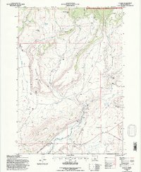
1992 Map of Paulina
USGS Topo · Published 1997About this map
The settlement of Paulina anchors this high-desert ranching landscape in Crook County, situated where the Paulina Highway follows the course of Beaver Creek. The map reflects a community defined by water management and livestock grazing, evidenced by named homesteads like the Minifie Ranch, Ferlan Ranch, and Congleton Ranch. Resource infrastructure is notably documented with an Elevated Aqueduct and a Gaging Station along the creek, supporting agricultural life at the edge of the Ochoco National Forest.
Find a feature on this map
45 named features on this map. Tap any name to fly to it.
Don’t see what you’re looking for? This feature index may not catch every label — zoom into the map to look around manually.
Map Details
Editions of this 1992 Paulina Map
This is the sole edition of this map. No revisions or reprints were ever made.
Other maps of this area

1932 · Dayville
USGS Topo · 1:125,000

1936 · Dayville
USGS Topo · 1:125,000

1955 · Bend
USGS Topo · 1:250,000

1955 · Canyon City
USGS Topo · 1:250,000

1957 · Bend
USGS Topo · 1:250,000

1958 · Bend
USGS Topo · 1:250,000

1959 · Canyon City
USGS Topo · 1:250,000

1966 · Keys Creek
USGS Topo · 1:24,000

1966 · Little Summit Prairie
USGS Topo · 1:24,000

1966 · Six Corners
USGS Topo · 1:24,000