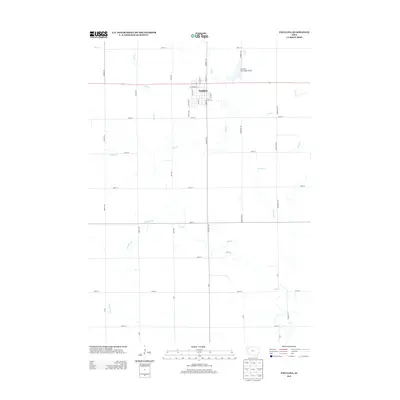
2013 Map of Paullina
USGS Topo · Published 2013About this map
Paullina serves as the central hub of this agricultural landscape in O'Brien County, where a strictly ordered grid of section roads defines the movement of modern rural life. The settlement's street plan is anchored by Main St and W Commerce St, with the Paullina Municipal Airport positioned northeast of the town center. Outside of the residential and commercial core, the map is dominated by the meandering paths of local waterways that contrast sharply with the straight-line precision of the road system. A series of small streams, including Mill Cr and the descriptively named Whiskey Cr, cut across the northern and southern sectors of the quadrangle. These drainage patterns, including Nelson Cr and Dry Run, illustrate the natural topography that underlies the intensive farming operations of this part of northwest Iowa.
Find a feature on this map
41 named features on this map. Tap any name to fly to it.
Don’t see what you’re looking for? This feature index may not catch every label — zoom into the map to look around manually.
Map Details
Editions of this 2013 Paullina Map
This is the sole edition of this map. No revisions or reprints were ever made.
Other maps of this area

1954 · Fairmont
USGS Topo · 1:250,000

1954 · Fort Dodge
USGS Topo · 1:250,000

1957 · Fort Dodge
USGS Topo · 1:250,000

1958 · Fort Dodge
USGS Topo · 1:250,000

1958 · Fairmont
USGS Topo · 1:250,000

1964 · Sheldon SE
USGS Topo · 1:24,000

1964 · Primghar
USGS Topo · 1:24,000

1964 · Gaza
USGS Topo · 1:24,000

1969 · Cleghorn
USGS Topo · 1:24,000
1969 · Marcus
USGS Topo · 1:24,000