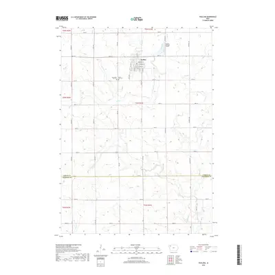
2018 Map of Paullina
USGS Topo · Published 2018About this map
Paullina serves as the central hub of this agricultural landscape in Northwest Iowa, positioned at the intersection of E Broadway St and S Main St. The town's grid is flanked by the Paullina Municipal Airport to the northeast and the dual burial grounds of West Prairie View Cem and Prairie View Cem just to the west. The terrain is defined by a dense network of watercourses, including Mill Creek, Mud Cr, and Whiskey Cr, which drain the surrounding farmland. This modern survey reflects the enduring section-line road system, with routes like Co Rd L48 and Co Hwy L40 providing access between farmsteads. The boundary between O'Brien Co and Cherokee Co is clearly demarcated in the southern portion of the map, illustrating the administrative divisions of this prairie region.
Find a feature on this map
53 named features on this map. Tap any name to fly to it.
Don’t see what you’re looking for? This feature index may not catch every label — zoom into the map to look around manually.
Map Details
Editions of this 2018 Paullina Map
This is the sole edition of this map. No revisions or reprints were ever made.
Other maps of this area

1954 · Fairmont
USGS Topo · 1:250,000

1954 · Fort Dodge
USGS Topo · 1:250,000

1957 · Fort Dodge
USGS Topo · 1:250,000

1958 · Fort Dodge
USGS Topo · 1:250,000

1958 · Fairmont
USGS Topo · 1:250,000

1964 · Sheldon SE
USGS Topo · 1:24,000

1964 · Primghar
USGS Topo · 1:24,000

1964 · Gaza
USGS Topo · 1:24,000

1969 · Cleghorn
USGS Topo · 1:24,000
1969 · Marcus
USGS Topo · 1:24,000