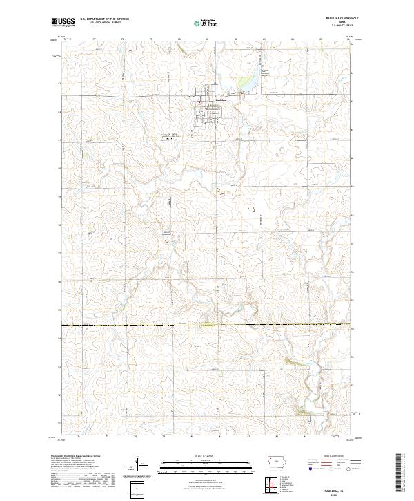
2022 Map of Paullina
USGS Topo · Published 2022About this map
Paullina serves as the central hub of this agricultural landscape, where a precise grid of rural roads like Oriole Ave and 470th St sections the fertile plains. The town's layout is clearly defined by its residential streets, including E Broadway St and S Main St, while the Paulina Municipal Airport and the Mill Creek Fitness Trl show the community's modern infrastructure and recreational spaces.
Find a feature on this map
54 named features on this map. Tap any name to fly to it.
Don’t see what you’re looking for? This feature index may not catch every label — zoom into the map to look around manually.
Map Details
Editions of this 2022 Paullina Map
This is the sole edition of this map. No revisions or reprints were ever made.
Other maps of this area

1954 · Fairmont
USGS Topo · 1:250,000

1954 · Fort Dodge
USGS Topo · 1:250,000

1957 · Fort Dodge
USGS Topo · 1:250,000

1958 · Fort Dodge
USGS Topo · 1:250,000

1958 · Fairmont
USGS Topo · 1:250,000

1964 · Sheldon SE
USGS Topo · 1:24,000

1964 · Primghar
USGS Topo · 1:24,000

1964 · Gaza
USGS Topo · 1:24,000

1969 · Cleghorn
USGS Topo · 1:24,000
1969 · Marcus
USGS Topo · 1:24,000