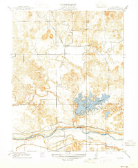
1915 Map of Paulsell
USGS Topo · Published 1915About this map
The Tuolumne River and the sprawling Modesto Reservoir dominate this 1913 survey of eastern Stanislaus County. The landscape reveals a sophisticated early 20th-century water management system, defined by the Modesto Ditch and Turlock Ditch cutting through the terrain to support regional agriculture. At the center of the local transportation network, the Sierra Railway of California passes through the settlement of Paulsell, a vital junction for the era's movement of goods and people. Near this rail line, the presence of the Horrs School serves as a marker of the small rural community that once thrived in the foothills. The detailed topography, mapped by J.B. Leavitt and F.A. Danforth, tracks the winding course of Dry Creek through a series of low ridges and valleys that define the geography before the river's descent toward the valley floor.
Find a feature on this map
8 named features on this map. Tap any name to fly to it.
Don’t see what you’re looking for? This feature index may not catch every label — zoom into the map to look around manually.
Map Details
Editions of this 1915 Paulsell Map
2 editions found
Other maps of this area

1913 · Dickenson
USGS Topo · 1:31,680

1915 · Oakdale
USGS Topo · 1:31,680

1915 · Paulsell
USGS Topo · 1:31,680

1916 · Three Tree Flat
USGS Topo · 1:31,680

1916 · Montpellier
USGS Topo · 1:31,680

1916 · Cooperstown
USGS Topo · 1:31,680

1916 · Denair
USGS Topo · 1:31,680

1916 · Waterford
USGS Topo · 1:31,680

1916 · Copperopolis
USGS Topo · 1:62,500

1939 · Modesto East
USGS Topo · 1:62,500