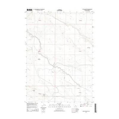
2015 Map of Pavillion Butte
USGS Topo · Published 2015About this map
Pavillion Butte and Pavillion Ridge anchor the southern landscape of this Fremont County quadrangle, where the terrain transitions into the distinct geographic features of the Wind River Basin. The area is defined by a sparse network of drainage systems and roads that speak to the ranching and rural character of the region. Fivemile Cr and Water Rocks Draw provide the primary hydrologic structure, while Sheep-Camp Drain cuts through the central sections. Local infrastructure is marked by named routes such as Arapahoe-Ranch Rd and the curiously named Disneyland Rd. To the northeast, the elevation rises toward Muddy Ridge, illustrating the arid, bench-and-draw topography typical of this part of Wyoming. The survey provides a clear view of the township and range divisions, tracing the rural development patterns through named thoroughfares like Teachers Rd and Indian Ridge Rd.
Find a feature on this map
19 named features on this map. Tap any name to fly to it.
Don’t see what you’re looking for? This feature index may not catch every label — zoom into the map to look around manually.
Map Details
Editions of this 2015 Pavillion Butte Map
This is the sole edition of this map. No revisions or reprints were ever made.
Other maps of this area

1950 · Pavillion
USGS Topo · 1:24,000

1950 · Pavillion Butte
USGS Topo · 1:24,000

1950 · Harris Bridge
USGS Topo · 1:24,000

1950 · Ocean Lake
USGS Topo · 1:24,000

1950 · Shotgun Butte
USGS Topo · 1:24,000

1951 · Eagle Point
USGS Topo · 1:24,000

1951 · Morton
USGS Topo · 1:24,000

1951 · Lookout Butte
USGS Topo · 1:24,000

1951 · Jenkins Mountain
USGS Topo · 1:24,000

1955 · Thermopolis
USGS Topo · 1:250,000