
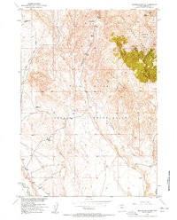
1951 Map of Jenkins Mountain
USGS Topo · Published 1953About this map
Wind River Indian Reservation lands dominate this central Wyoming landscape, where the southern slopes of the Owl Creek Mountains meet the high plains. The map illustrates a transitional environment shaped by mid-century land management and early frontier holdovers, featuring isolated structures such as Leisner Cabin and Green Cabin. The topography is defined by the prominent Jenkins Mountain and the surrounding Jenkins Basin, with drainages like Sheep Creek and Cottonwood Creek carving through the terrain.
Find a feature on this map
55 named features on this map. Tap any name to fly to it.
Don’t see what you’re looking for? This feature index may not catch every label — zoom into the map to look around manually.
Map Details
Editions of this 1951 Jenkins Mountain Map
This is the sole edition of this map. No revisions or reprints were ever made.
Other maps of this area

1950 · Pavillion Butte
USGS Topo · 1:24,000

1950 · Harris Bridge
USGS Topo · 1:24,000

1950 · Mexican Pass SW
USGS Topo · 1:24,000

1950 · Shotgun Butte
USGS Topo · 1:24,000

1951 · Mexican Pass
USGS Topo · 1:24,000

1952 · Kates Basin
USGS Topo · 1:24,000

1952 · Sheep Ridge
USGS Topo · 1:24,000

1955 · Thermopolis
USGS Topo · 1:250,000
1957 · Jenkins Mountain
USGS Topo · 1:24,000

1958 · Thermopolis
USGS Topo · 1:250,000