
1951 Map of Mexican Pass
USGS Topo · Published 1953About this map
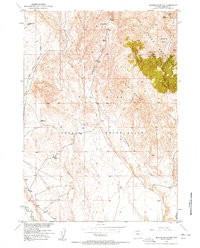
The Owl Creek Mountains dominate this central Wyoming landscape, creating a formidable geographic boundary between the Big Horn Basin and the Wind River Indian Reservation. A sparse network of trails and the Mexican Pass Road provide the primary transit through this arid terrain, linking remote outposts like Engle Ranch and the Mexican Place. The map illustrates a landscape where water is the defining resource for survival and ranching, evidenced by scattered names like Mexican Spring, Indian Trails Spring, and Water Cress Spring.
Find a feature on this map
25 named features on this map. Tap any name to fly to it.
Don’t see what you’re looking for? This feature index may not catch every label — zoom into the map to look around manually.
Map Details
Editions of this 1951 Mexican Pass Map
This is the sole edition of this map. No revisions or reprints were ever made.
Other maps of this area

1950 · Harris Bridge
USGS Topo · 1:24,000

1950 · Mexican Pass SW
USGS Topo · 1:24,000

1951 · Mexican Pass SE
USGS Topo · 1:24,000

1951 · Morrison Canyon
USGS Topo · 1:24,000

1951 · Jenkins Mountain
USGS Topo · 1:24,000

1952 · Kates Basin
USGS Topo · 1:24,000

1955 · Thermopolis
USGS Topo · 1:250,000
1957 · Jenkins Mountain
USGS Topo · 1:24,000

1958 · Thermopolis
USGS Topo · 1:250,000
1958 · Harris Bridge
USGS Topo · 1:24,000