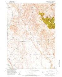
1957 Map of Jenkins Mountain
USGS Topo · Published 1958About this map
The Wind River Indian Reservation occupies the southern half of this landscape, where the high peaks of the Owl Creek Mountains give way to a complex drainage network. Mapped during the late 1940s and early 1950s, this area reflects a remote ranching and grazing environment where human presence is marked only by isolated outposts such as Leisner Cabin and Green Cabin. The high point of Jenkins Mountain dominates the northeast, overlooking Jenkins Basin and the prominent Twin Buttes to the southwest. Water sources are critical here, with the East Fork Sheep Creek, Cottonwood Creek, and Muddy Creek cutting through the foothills. This survey, part of the Department of the Interior's Missouri River Basin development program, provides a technical record of the land as it appeared before modern infrastructure changed the character of these mountain basins.
Find a feature on this map
14 named features on this map. Tap any name to fly to it.
Don’t see what you’re looking for? This feature index may not catch every label — zoom into the map to look around manually.
Map Details
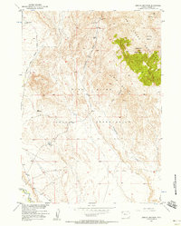
Editions of this 1957 Jenkins Mountain Map
2 editions found
Other maps of this area

1950 · Pavillion Butte
USGS Topo · 1:24,000

1950 · Harris Bridge
USGS Topo · 1:24,000

1950 · Mexican Pass SW
USGS Topo · 1:24,000

1950 · Shotgun Butte
USGS Topo · 1:24,000

1951 · Mexican Pass
USGS Topo · 1:24,000

1951 · Jenkins Mountain
USGS Topo · 1:24,000

1952 · Kates Basin
USGS Topo · 1:24,000

1952 · Sheep Ridge
USGS Topo · 1:24,000

1955 · Thermopolis
USGS Topo · 1:250,000

1958 · Thermopolis
USGS Topo · 1:250,000