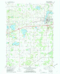
1981 Map of Paw Paw
USGS Topo · Published 1982About this map
Maple Lake and the Paw Paw River anchor the village of Paw Paw in this early 1980s landscape of southwest Michigan. The settlement pattern reveals a transition from the village core, with institutions like Lakeview Hospital and the Cedar Street Sch, toward a landscape increasingly defined by major transit corridors. The Ohio and Chesapeake Highway and Red Arrow Highway intersect near the village, while the Amtrak line cuts across the southern portion of the quadrangle.
Find a feature on this map
68 named features on this map. Tap any name to fly to it.
Don’t see what you’re looking for? This feature index may not catch every label — zoom into the map to look around manually.
Map Details
Editions of this 1981 Paw Paw Map
This is the sole edition of this map. No revisions or reprints were ever made.
Other maps of this area

1927 · Hartford
USGS Topo · 1:62,500

1927 · Bangor
USGS Topo · 1:62,500

1931 · Bangor
USGS Topo · 1:62,500

1931 · Hartford
USGS Topo · 1:62,500

1943 · Bangor
USGS Topo · 1:62,500

1944 · Marcellus
USGS Topo · 1:62,500

1946 · Marcellus
USGS Topo · 1:62,500

1946 · Gobles
USGS Topo · 1:62,500

1948 · Gobles
USGS Topo · 1:62,500

1949 · Gobles
USGS Topo · 1:62,500