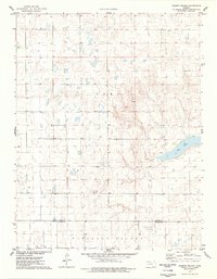
1976 Map of Pawnee Mound
USGS Topo · Published 1978About this map
Pawnee Mound rises as a prominent landmark above the western Kansas high plains in the late 1970s, marking a landscape defined by dramatic elevation shifts and sparse water sources. The map highlights a stark contrast between the elevated plateau and the broad, depressed basin of Pleasant Valley to the south. Central to the geography is the large expanse of Dry Lake, a feature that implies the seasonal nature of surface water in this arid environment. The transition between Scott Co and Finney Co is clearly delineated, crossing through terrain where the presence of multiple wells suggests a reliance on groundwater for agricultural or industrial use. This U.S. Geological Survey topographic record captures the region's topographical character before modern large-scale developments might have altered the visible landforms and drainage patterns.
Find a feature on this map
6 named features on this map. Tap any name to fly to it.
Don’t see what you’re looking for? This feature index may not catch every label — zoom into the map to look around manually.
Map Details
Editions of this 1976 Pawnee Mound Map
This is the sole edition of this map. No revisions or reprints were ever made.
Other maps of this area

1940 · Scott City
USGS Topo · 1:62,500

1944 · Tennis
USGS Topo · 1:62,500

1951 · Scott City
USGS Topo · 1:62,500

1955 · Scott City
USGS Topo · 1:250,000

1958 · Scott City
USGS Topo · 1:250,000
1974 · Scott City 4 NW
USGS Topo · 1:24,000

1974 · Amy SW
USGS Topo · 1:24,000

1974 · Grigston
USGS Topo · 1:24,000
1976 · Shallow Water
USGS Topo · 1:24,000
1976 · Tennis
USGS Topo · 1:24,000