
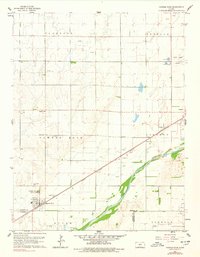
1960 Map of Pawnee Rock
USGS Topo · Published 1961About this map
The Pawnee Rock State Park serves as the focal point of this 1960 survey, preserving a landmark once vital to travelers on the Santa Fe Trail. The terrain is defined by the broad valley of the Arkansas River, which cuts across the southeast corner of the quadrangle, joined by the winding course of Ash Creek. This agricultural landscape is tied together by the Atchison Topeka and Santa Fe railroad, which parallels the river and serves the grain and transit needs of settlements like Dundee.
Find a feature on this map
24 named features on this map. Tap any name to fly to it.
Don’t see what you’re looking for? This feature index may not catch every label — zoom into the map to look around manually.
Map Details
Editions of this 1960 Pawnee Rock Map
2 editions found
Other maps of this area

1889 · Larned
USGS Topo · 1:125,000

1891 · Great Bend
USGS Topo · 1:125,000

1891 · Larned
USGS Topo · 1:125,000

1893 · Great Bend
USGS Topo · 1:125,000

1955 · Great Bend
USGS Topo · 1:250,000

1957 · Great Bend
USGS Topo · 1:250,000

1958 · Great Bend
USGS Topo · 1:250,000

1958 · Great Bend
USGS Topo · 1:24,000

1959 · Great Bend NE
USGS Topo · 1:24,000
1960 · Heizer
USGS Topo · 1:24,000