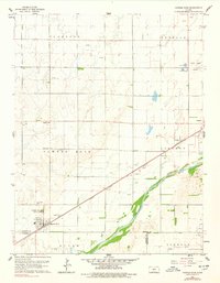
1960 Map of Pawnee Rock
USGS Topo · Published 1978About this map
Arkansas River bottomlands define the southern half of this mid-century survey, where the river winds along the border between Barton and Pawnee Counties. The landscape is dominated by the industrial and agricultural rhythm of central Kansas, marked by numerous Oil Wells and Gravel Pits that punctuate the rolling plains. The town of Pawnee Rock sits as a central hub, situated near the Pawnee Rock State Park and the historic Atchison Topeka and Santa Fe railroad line. Local genealogy and community history are anchored by landmarks such as Bergtal Ch, Pawnee Rock Cem, and the Dundee Valley Cem near the small settlement of Dundee. To the north, the terrain transitions into the high plains of the Clarence and Buffalo townships, while Ash Creek provides a secondary drainage system in the south.
Find a feature on this map
25 named features on this map. Tap any name to fly to it.
Don’t see what you’re looking for? This feature index may not catch every label — zoom into the map to look around manually.
Map Details
Editions of this 1960 Pawnee Rock Map
2 editions found
Other maps of this area

1889 · Larned
USGS Topo · 1:125,000

1891 · Great Bend
USGS Topo · 1:125,000

1891 · Larned
USGS Topo · 1:125,000

1893 · Great Bend
USGS Topo · 1:125,000

1955 · Great Bend
USGS Topo · 1:250,000

1957 · Great Bend
USGS Topo · 1:250,000

1958 · Great Bend
USGS Topo · 1:250,000

1958 · Great Bend
USGS Topo · 1:24,000

1959 · Great Bend NE
USGS Topo · 1:24,000

1960 · Pawnee Rock
USGS Topo · 1:24,000