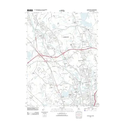
2012 Map of Pawtucket
USGS Topo · Published 2012About this map
The Blackstone River carves a path through this industrial and residential landscape, anchoring a string of mill-era settlements including Manville, Albion, and Berkeley. The influence of early textile production is evident in the dense street grids and sites like the Sayles Bleachery and the Ashton village, which features the prominent Ashton Viaduct. Transportation networks dominate the corridor, with the P & W RR and Interstate 295 intersecting the valley near the Albion Bridge. Away from the river, the landscape rises into significant high points such as Diamond Hill and Beacon Pole Hill, while heritage sites like the Quaker Burying Ground and Brown and Bucklin Families Cem offer deep genealogical connections. The southern portion of the area transitions into managed recreation and preserved history at Lincoln Woods State Park and the historic Follett-Carpenter House and Farm, reflecting the shift from a strictly industrial valley to a suburbanized residential region.
Find a feature on this map
120 named features on this map. Tap any name to fly to it.
Don’t see what you’re looking for? This feature index may not catch every label — zoom into the map to look around manually.
Map Details
Editions of this 2012 Pawtucket Map
This is the sole edition of this map. No revisions or reprints were ever made.
Other maps of this area

1886 · Blackstone
USGS Topo · 1:62,500

1887 · Franklin
USGS Topo · 1:62,500

1887 · Providence
USGS Topo · 1:62,500

1889 · Providence
USGS Topo · 1:62,500

1889 · Blackstone
USGS Topo · 1:62,500

1889 · Franklin
USGS Topo · 1:62,500

1889 · Burrillville
USGS Topo · 1:62,500

1893 · Franklin
USGS Topo · 1:62,500

1893 · Blackstone
USGS Topo · 1:62,500

1894 · Burrillville
USGS Topo · 1:62,500