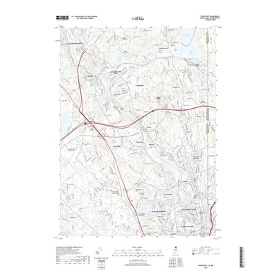
2018 Map of Pawtucket
USGS Topo · Published 2018About this map
The Blackstone River carves through this northern Rhode Island corridor, anchoring a chain of industrial settlements including Pawtucket, Central Falls, and Lonsdale. The landscape reflects a dense integration of transport and water power, with the Blackstone Valley RR and several historic river crossings like the Ashton Viaduct and Albion Bridge connecting the valley floors. Higher elevations such as Copper Mine Hill and Sayles Hill provide a contrast to the urbanized riverbanks, while Lincoln Woods Rd and Olney Pond preserve significant green space amidst the suburban growth of Cumberland and Lincoln. Genealogists will find a wealth of local landmarks, including the Moshassuck Cem and the Wilkinson Cem and Tomb, alongside established institutions like the Community College of Rhode Island at the Jenckes Hill campus.
Find a feature on this map
106 named features on this map. Tap any name to fly to it.
Don’t see what you’re looking for? This feature index may not catch every label — zoom into the map to look around manually.
Map Details
Editions of this 2018 Pawtucket Map
This is the sole edition of this map. No revisions or reprints were ever made.
Other maps of this area

1886 · Blackstone
USGS Topo · 1:62,500

1887 · Franklin
USGS Topo · 1:62,500

1887 · Providence
USGS Topo · 1:62,500

1889 · Providence
USGS Topo · 1:62,500

1889 · Blackstone
USGS Topo · 1:62,500

1889 · Franklin
USGS Topo · 1:62,500

1889 · Burrillville
USGS Topo · 1:62,500

1893 · Franklin
USGS Topo · 1:62,500

1893 · Blackstone
USGS Topo · 1:62,500

1894 · Burrillville
USGS Topo · 1:62,500