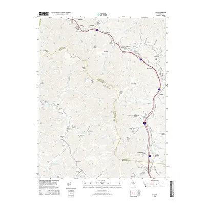
2014 Map of Pax
USGS Topo · Published 2014About this map
Paint Creek carves a deep path through the coal-rich plateau of the West Virginia mountains, following the boundary line between Fayette and Raleigh counties. This landscape is defined by its deep hollows and high knobs, where industry and community have long coexisted. The modern transportation corridor, marked by the Stanley Bender Memorial Bridge and the West Virginia Turnpike Bridge, contrasts with the older settlement patterns visible at Artie, Clear Creek, and Pax. Genealogists will find a wealth of burial sites throughout these hills, including the Kingston Cemeteries, Lively Cem, and Maynor Cem. The industrial footprint of the region is evident in features like the Rowland Mine Impoundment and the Lookout Tower atop Lick Knob, highlighting the historical reliance on timber and coal extraction that shaped these mountain communities.
Find a feature on this map
128 named features on this map. Tap any name to fly to it.
Don’t see what you’re looking for? This feature index may not catch every label — zoom into the map to look around manually.
Map Details
Editions of this 2014 Pax Map
This is the sole edition of this map. No revisions or reprints were ever made.
Other maps of this area

1891 · Raleigh
USGS Topo · 1:125,000

1897 · Kanawha Falls
USGS Topo · 1:125,000

1897 · Raleigh
USGS Topo · 1:125,000

1900 · Kanawha Falls
USGS Topo · 1:125,000

1901 · Kanawha Falls
USGS Topo · 1:125,000

1902 · Raleigh
USGS Topo · 1:125,000

1908 · Fayetteville
USGS Topo · 1:48,000

1908 · Montgomery
USGS Topo · 1:48,000

1910 · Fayetteville
USGS Topo · 1:62,500

1910 · Montgomery
USGS Topo · 1:62,500