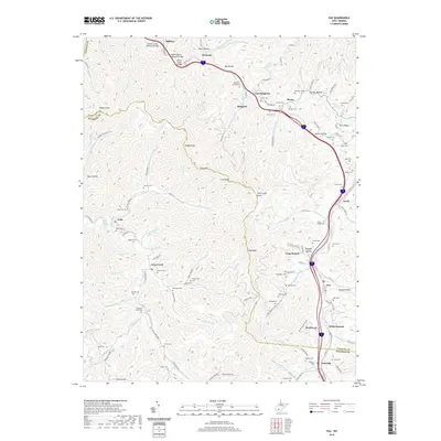
2019 Map of Pax
USGS Topo · Published 2019About this map
The town of Pax and the surrounding coal-country communities of Weirwood and Willis Branch anchor this 2019 survey, where the West Virginia Turnpike carves through the narrow valleys of the Fayette and Raleigh county line. This modern topographic study reveals a landscape heavily shaped by its rugged topography and the industrial corridors following Paint Creek and Clear Fork. The high concentration of family and community burial grounds, such as Sutphin Cem, Lafferty Cem, and the Cottle Cemeteries, reflects the deep ancestral roots in the hollows around Lively and Artie. From the high point at High Knob to the depths of Shotgun Hollow, the map illustrates how transportation infrastructure like the Stanley Bender Memorial Bridge and various county routes must navigate the complex terrain of Paint Mtn and Hodge Knob.
Find a feature on this map
137 named features on this map. Tap any name to fly to it.
Don’t see what you’re looking for? This feature index may not catch every label — zoom into the map to look around manually.
Map Details
Editions of this 2019 Pax Map
This is the sole edition of this map. No revisions or reprints were ever made.
Other maps of this area

1891 · Raleigh
USGS Topo · 1:125,000

1897 · Kanawha Falls
USGS Topo · 1:125,000

1897 · Raleigh
USGS Topo · 1:125,000

1900 · Kanawha Falls
USGS Topo · 1:125,000

1901 · Kanawha Falls
USGS Topo · 1:125,000

1902 · Raleigh
USGS Topo · 1:125,000

1908 · Fayetteville
USGS Topo · 1:48,000

1908 · Montgomery
USGS Topo · 1:48,000

1910 · Fayetteville
USGS Topo · 1:62,500

1910 · Montgomery
USGS Topo · 1:62,500