Loading...
Loading map...2023 Map of Pax
USGS Topo · Published 2023About this map
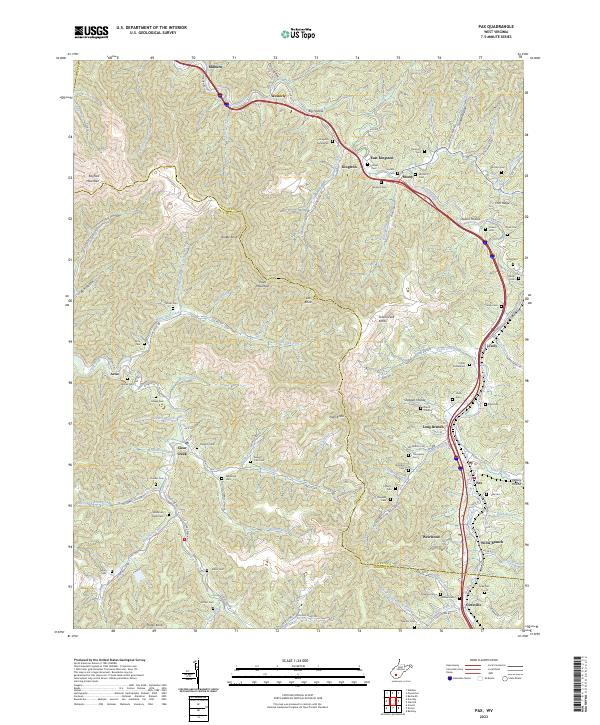
Paint Creek winds through the deep valleys of the Fayette and Raleigh county line, anchoring a string of mountain communities including Milburn, Westerly, and Kingston. The landscape is defined by the high elevations of Kayford Mountain and Paint Mountain, where numerous small hollows like Dark Hollow and Shotgun Hollow provided the geography for tight-knit settlements.
Find a feature on this map
124 named features on this map. Tap any name to fly to it.
Don’t see what you’re looking for? This feature index may not catch every label — zoom into the map to look around manually.
Map Details
Date Portrayed2023
Date Published2023
PublisherU.S. Geological Survey
Map TypeTopographic
Scale1:24000
Physical Dimensions24 x 29 inches
Editions of this 2023 Pax Map
This is the sole edition of this map. No revisions or reprints were ever made.
Historical Maps of East Kingston Through Time
Featured Locations
Source Details
SourceU.S. Geological Survey
CopyrightPublic Domain