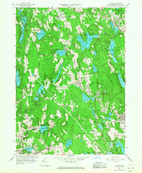
1965 Map of Paxton
USGS Topo · Published 1968About this map
Industrial villages and academic institutions punctuate the central Massachusetts hills in this mid-century survey. The landscape is defined by its water management, featuring a dense network of reservoirs including Kettle Brook Reservoir No 4 and Holden Reservoir No 1 that supplied the growing needs of Worcester. The presence of Upper Wire Village and Lower Wire Village suggests the region's enduring manufacturing roots, while institutional sites like Anna Maria College, the VA Hospital, and the Nazareth Home for Boys highlight its role as a regional center for education and care.
Find a feature on this map
123 named features on this map. Tap any name to fly to it.
Don’t see what you’re looking for? This feature index may not catch every label — zoom into the map to look around manually.
Map Details
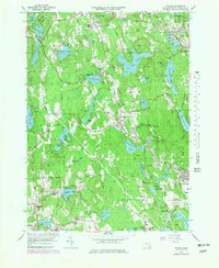
Editions of this 1965 Paxton Map
2 editions found
Other maps of this area

1885 · Worcester
USGS Topo · 1:62,500

1886 · Worcester
USGS Topo · 1:62,500

1887 · Brookfield
USGS Topo · 1:62,500

1887 · Barre
USGS Topo · 1:62,500

1889 · Webster
USGS Topo · 1:62,500

1889 · Barre
USGS Topo · 1:62,500

1890 · Brookfield
USGS Topo · 1:62,500

1892 · Webster
USGS Topo · 1:62,500

1892 · Worcester
USGS Topo · 1:62,500

1893 · Brookfield
USGS Topo · 1:62,500