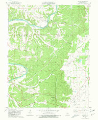
1981 Map of Paydown
USGS Topo · Published 1981About this map
The Gasconade River winds through the heart of this landscape, its path defined by sharp bends and high bluffs in the southern Missouri hills. Near the riverside settlement of Paydown, the map identifies the Paydown Gasconade River Public Access and Paydown Club, highlighting the river's role as a center for local recreation and water access. To the south, the topography shifts towards the higher ground of the Vichy area, where the Vichy Lookout Tower stands as a prominent landmark near Spring Creek Gap Roadside Park.
Find a feature on this map
39 named features on this map. Tap any name to fly to it.
Don’t see what you’re looking for? This feature index may not catch every label — zoom into the map to look around manually.
Map Details
Editions of this 1981 Paydown Map
2 editions found
Other maps of this area

1934 · Linn
USGS Topo · 1:48,000

1934 · Bland
USGS Topo · 1:62,500

1934 · Redbird
USGS Topo · 1:62,500

1937 · Bland
USGS Topo · 1:62,500

1937 · Vienna
USGS Topo · 1:62,500

1938 · Redbird
USGS Topo · 1:62,500

1938 · Vienna
USGS Topo · 1:48,000

1942 · Linn
USGS Topo · 1:62,500

1945 · Linn
USGS Topo · 1:62,500

1949 · Saint Louis
USGS Topo · 1:250,000