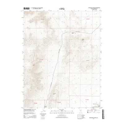
2014 Map of Paymaster Canyon
USGS Topo · Published 2014About this map
Paymaster Canyon carves through the arid landscape of Esmeralda County, defining a rugged corridor through the Weepah Hills and General Thomas Hills. The area is characterized by significant topographical relief, rising to landmarks like Paymaster Summit and the prominent Paymaster Ridge. This terrain dictates the path of Paymaster Canyon Rd, which serves as the primary artery through this high-desert environment. To the southeast, the elevation drops toward the Montezuma Valley, where the ephemeral Alkali Lake sits as a catchment point. The map provides a clear look at the township and range survey lines, such as t1n r41e, which organize this sparsely populated portion of Nevada. The landscape remains largely dominated by its natural landforms, with road access strictly following the canyon floors and natural passes.
Find a feature on this map
15 named features on this map. Tap any name to fly to it.
Don’t see what you’re looking for? This feature index may not catch every label — zoom into the map to look around manually.
Map Details
Editions of this 2014 Paymaster Canyon Map
This is the sole edition of this map. No revisions or reprints were ever made.
Other maps of this area

1898 · Silver Peak
USGS Topo · 1:125,000

1900 · Silver Peak
USGS Topo · 1:125,000

1907 · Tonopah
USGS Topo · 1:250,000

1908 · Lida
USGS Topo · 1:250,000

1908 · Tonopah
USGS Topo · 1:250,000

1913 · Lida
USGS Topo · 1:250,000

1945 · Goldfield
USGS Topo · 1:125,000

1954 · Goldfield
USGS Topo · 1:250,000

1955 · Goldfield
USGS Topo · 1:250,000

1956 · Tonopah
USGS Topo · 1:250,000