
1951 Map of Payment
USGS Topo · Published 1958About this map
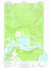
The international border between the United States and Canada bisects this mid-century survey, following the waters of the Saint Marys River and the Old Channel. On the Michigan side, the northern reaches of Sugar Island contain small clusters of homes at Payment and Mc Farland, alongside the Holy Angel Ch. Across the water in Ontario, the Canadian Pacific railroad tracks hug the shoreline, serving the Garden River settlement and the Garden River Indian Reserve. The landscape is a complex network of wetlands and small lakes like Mabel Lake and Surette Lake, which drain toward the wide expanse of Little Lake George. This map captures a specific moment in the maritime geography of the St. Marys system, detailing numerous navigation aids such as a Bell Point pylon, various cribs, and a submerged stake in the shipping channels.
Find a feature on this map
51 named features on this map. Tap any name to fly to it.
Don’t see what you’re looking for? This feature index may not catch every label — zoom into the map to look around manually.
Map Details
Editions of this 1951 Payment Map
2 editions found
Other maps of this area

1913 · Sault Sainte Marie
USGS Topo · 1:62,500

1919 · Neebish
USGS Topo · 1:62,500

1941 · Neebish
USGS Topo · 1:63,360

1941 · Sault Sainte Marie
USGS Topo · 1:63,360

1951 · Baie De Wasai
USGS Topo · 1:24,000

1951 · Sault Ste. Marie
USGS Topo · 1:62,500

1951 · Sault Ste. Marie South
USGS Topo · 1:24,000

1951 · Lake George
USGS Topo · 1:62,500

1954 · Sault Sainte Marie
USGS Topo · 1:250,000

1956 · Sault Sainte Marie
USGS Topo · 1:250,000