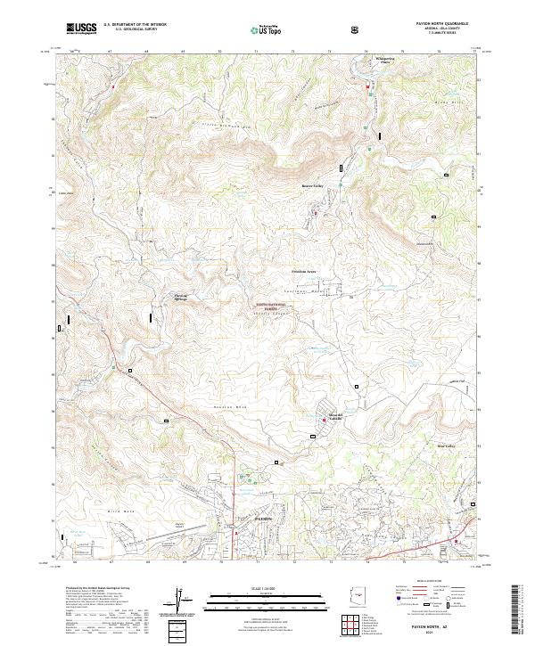
2021 Map of Payson North
USGS Topo · Published 2021About this map
Tonto National Forest envelopes the high country of Gila County, where the topography is defined by the sharp descent from the Little Diamond Rim and Diamond Rim. The E Verde River carves through the landscape, supporting a series of small residential enclaves such as Whispering Pines and Beaver Valley. To the south, the northern periphery of Payson and Star Valley shows a transition from forest to more developed residential and infrastructure zones, anchored by the Payson Airport. The map documents a complex network of canyons and mesas, including Shoofly Canyon and Houston Mesa, reflecting a landscape where water sources like Flowing Springs and numerous tanks, such as Shoofly Tanks and Racetrack Tank, were critical to both settlement and land management. This survey provides a precise look at the intersection of wildland and community expansion at the start of the 2020s.
Find a feature on this map
126 named features on this map. Tap any name to fly to it.
Don’t see what you’re looking for? This feature index may not catch every label — zoom into the map to look around manually.
Map Details
Editions of this 2021 Payson North Map
This is the sole edition of this map. No revisions or reprints were ever made.
Other maps of this area

1887 · Verde
USGS Topo · 1:250,000

1892 · Verde
USGS Topo · 1:250,000

1934 · Pine
USGS Topo · 1:62,500

1934 · Promontory Butte
USGS Topo · 1:62,500

1936 · Payson
USGS Topo · 1:48,000

1937 · Diamond Butte
USGS Topo · 1:48,000

1939 · Promontory Butte
USGS Topo · 1:62,500

1940 · Pine
USGS Topo · 1:62,500

1942 · Payson
USGS Topo · 1:62,500

1943 · Diamond Butte
USGS Topo · 1:62,500